TOSSO CREEK PROJECT
SURINAME
Tosso Creek Project
The 96-square-kilometer Tosso Creek Project is located in southern Suriname, approximately 180 km south of the capital city of Paramaribo. The project can be accessed by boat across the Brokopondo reservoir and then by road, or by air to the Sara Kreek Airstrip then by road. Tosso Creek is situated at the southern end of a highly mineralized sequence of metavolcanics and metasediments known as the Parakama Formation, which extends for over 100 km. The formation hosts numerous artisanal mining operations, including the Sara Kreek gold fields, which lie approximately 34 km northwest of Tosso Creek. Structurally, the region is interpreted to have been isoclinally folded and crosscut by a major east-northeast – west-southwest structural break. The Central Guiana Shear Zone, which is associated with Sela Creek and Antino, is approximately 5 km to the west of the project. Reconnaissance mapping by the Company has identified a north-south penetrative structural fabric, parallel shearing and quartz veining.
Geologically, the Tosso Creek project is interpreted to be underlain by both volcano-sedimentary and granitic rock units, with the contact between the two units running diagonally across the property, roughly from the northeast to the southwest corner of the concession (see Figure 1). Both historic and active alluvial mining have occurred in several areas on the project, both within the volcano-sedimentary rock units located in the western portion of the project area and proximal to the contact with the granites to the east. Despite the significant occurrences of artisanal mining at Tosso Creek, there is no record of any modern exploration having been carried out to identify the hard rock source of the alluvial or artisanal gold that has been mined there.
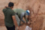
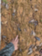
Greenheart Gold’s exploration programs to date include the completion of two phases of soil sampling covering the extent of the greenstone rock units as well as the greenstone/granite contact zones. Results received to date indicate a strong gold in soil anomaly of approximately 5 km by 500 m in the western half of the project area as well as several broad soil anomalies associated with the contact zone. A trenching program is currently underway with early results over the 5 km western anomaly including broad intercepts including 86.0 m grading 0.63 g/t Au and 62.0 m grading 0.71 g/t Au. Greenheart Gold has mobilized a second excavator to site to speed up trenching and road building programs in advance of an initial drill program which could be targeted to begin as early as the end of Q2, 2026.
For additional information on Tosso Creek, including Greenheart Gold’s more recent exploration programs and results, please refer to our press releases, which can be found on our website.
Figure 1: Tosso Creek geology map

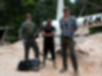
Photos Gallery